Section 02
Infrastructure
Basins, quays, depths, and the layout of the Algeciras Bay complex.
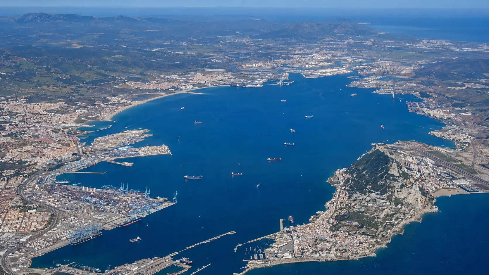
The Bay of Algeciras port complex comprises eight distinct sub-facilities distributed across approximately twenty kilometres of coastline. The basins, quays, and berths recorded in this section reflect the configuration as constituted at the close of the 2010 reporting year. Total quay length across the Port of Algeciras infrastructure exceeds ten kilometres; cumulative storage area, including the inland customs yards, approaches four hundred hectares.
The Algeciras port proper
The historic port at the mouth of the Río de la Miel, in the urban centre of Algeciras, comprises the Galera, Pesquero, and Crinavis basins together with the Juan Carlos I Quay. Juan Carlos I, completed in stages between the 1990s and the late 2000s, is the principal container handling location of the original port. The quay length at Juan Carlos I is approximately 2,100 metres, with alongside depths of 16 to 17 metres permitting the accommodation of New Panamax and post-Panamax container vessels.
The Galera basin, smaller and shallower, serves general cargo, project cargo, and certain Roll-on/Roll-off (RoRo) movements. The Pesquero basin remains in use by the local fishing fleet, with associated cold storage and processing facilities ashore. The Crinavis basin, historically used for shipbuilding, retains a graving dock and supports occasional ship repair work.
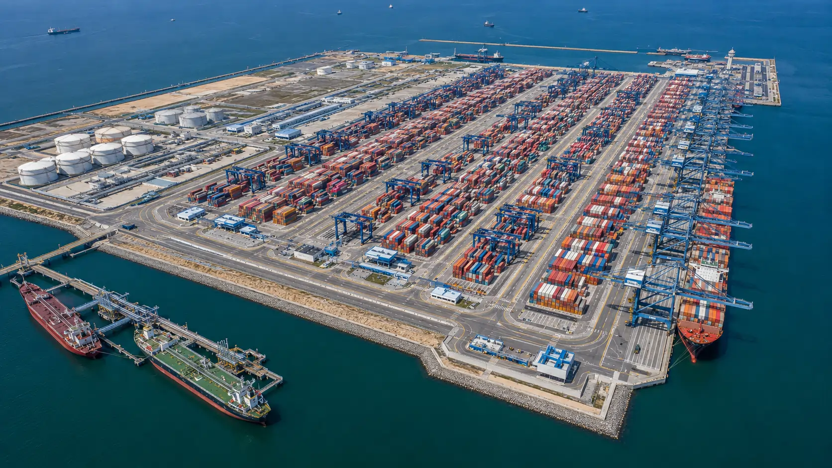
Isla Verde Exterior expansion
The Isla Verde Exterior expansion, developed on reclaimed land seaward of the original Isla Verde, constitutes the most significant capacity addition to the Port of Algeciras infrastructure in the period 2000–2010. The site hosts the TTI Algeciras semi-automated container terminal, the EVOS Algeciras SAU fuel storage installation, and supporting infrastructure for bunkering operations. Quay length at TTI Algeciras is approximately 1,200 metres, with alongside depth of 18.5 metres — among the deepest container berth approaches in the Mediterranean.
The semi-automated character of TTI Algeciras — a feature shared at the time of writing with only a small number of European container terminals — relies on automated stacking cranes (ASCs) in the yard, with manned operations preserved at the quayside (ship-to-shore cranes) and at the truck and rail interface. The arrangement permits high throughput density on a relatively constrained land footprint, an operational consideration of significance given the geographic limits on further port expansion at Algeciras.
Campamento and San Roque facilities
On the western side of the bay, the Campamento port at San Roque comprises specialised industrial berths serving the Cepsa refinery, the Acerinox stainless steel plant, and a number of petrochemical installations. The Cepsa refinery jetty handles crude oil imports from West Africa, the Middle East, and the Caspian region; refined product exports leave by the same facility for European and trans-Atlantic markets.
The Campamento area also accommodates the bulk import terminal for the Endesa thermal power station at Los Barrios, which during 2010 operated as one of the larger coal-fired generating stations in southern Spain. Bulk handling installations at Campamento are equipped with grab cranes and conveyor systems sized for capesize and panamax bulk carriers.
La Línea and the eastern bay
The eastern shore of the bay, in the municipality of La Línea de la Concepción, hosts limited port facilities — principally a small craft harbour and a fishing port. Industrial port functions on the eastern side of the bay are concentrated at Gibraltar, under separate British administration, and accordingly fall outside the scope of this Handbook.
Common navigational features
Vessels approaching the Algeciras complex transit the Strait of Gibraltar before turning into the Bay of Gibraltar from the south. The approach channel offers no significant restrictions for vessels of the largest commercial classes; the Strait is sufficiently deep that there is no entrance channel dredging requirement. Within the bay, pilotage is compulsory for commercial vessels above 500 GT; pilot boarding takes place at a designated station offshore of Tarifa.
The principal navigational hazards relate not to depth but to traffic density and weather. The Strait carries one of the heaviest concentrations of merchant shipping in the world, with east-west deep-sea traffic, north-south ferry traffic, and local fishing and recreational craft converging in a confined area. Vessel Traffic Service (VTS) for the Strait is operated jointly by the Spanish and Moroccan authorities; the system is treated in detail in Section 8.
Reading the Bay
The Bay of Gibraltar is, in formal nautical usage, the body of water enclosed by the Iberian Peninsula on the west, north, and east shores and by the Strait of Gibraltar to the south. The Spanish-language designation Bahía de Algeciras emphasises the bay's commercial focus on the Algeciras shore; the English-language usage Bay of Gibraltar follows historical Royal Navy charting conventions. Both names refer to the same body of water.